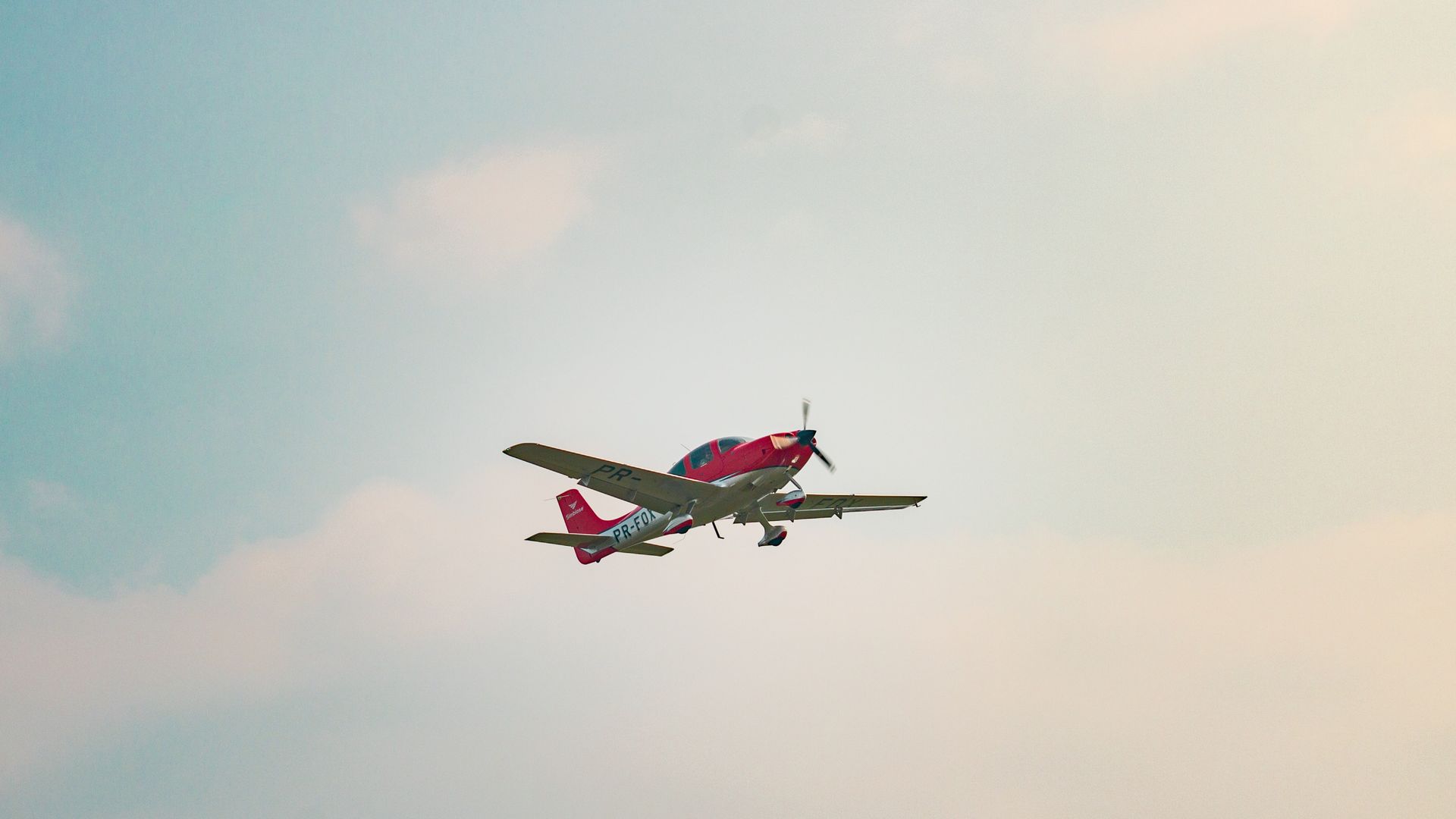

Cirrus SR22 single-engine aircraft flying in a clear sky
For general aviation pilots

An AI-native Electronic Flight Bag.

Route briefs, aircraft-aware planning, FAA weather, IFR/VFR charts, 3D terrain, and voice debriefs that turn shutdown notes into logbook entries. The same engine also powers a free live flight tracker, open to anyone.

Just here for the live map? Open the free flight tracker

Download the Android appGet it on Google Play
BUILT FOR GENERAL AVIATION · WEB · IPAD · ANDROID
AIRCRAFT TRACKEDReal-time
POSITION LATENCY< 2 s
ADS-B FEEDER SOURCES297
FAA CHART CYCLES PER YEAR13

See the airspace you’re actually flying in.

Most apps draw airspace as flat blue lines on a 2D map. Fly Overhead renders the real shelf - the Class B wedding cake, the restricted-area walls, the terrain underneath - so you can see the box you have to stay inside of, not just trace it.

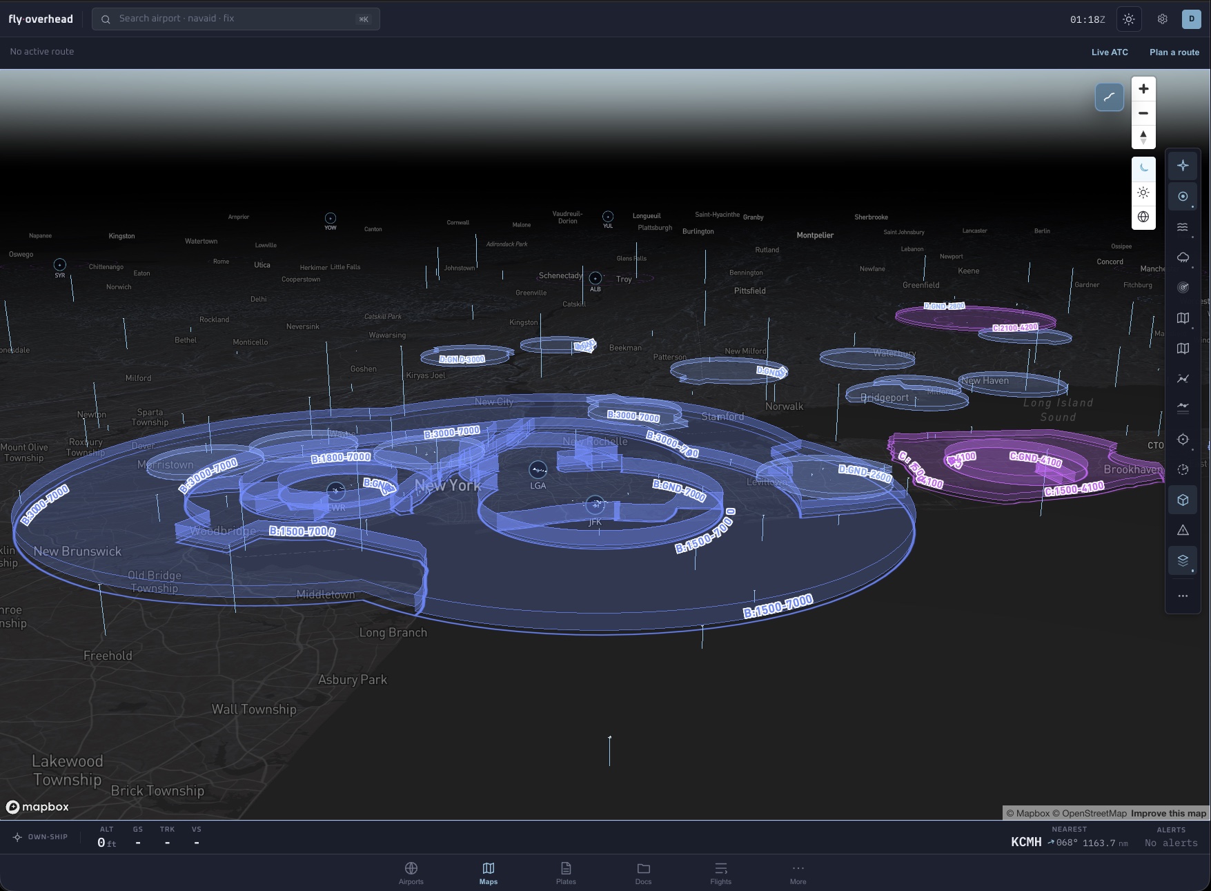
3D Class B, C, and D airspace shells rendered over the New York metro area with altitude floors and ceilings labeled
3D AirspaceClass B, C, and D rendered as the shelves they really are - every floor and ceiling labeled in place, so the “wedding cake” finally looks like one.
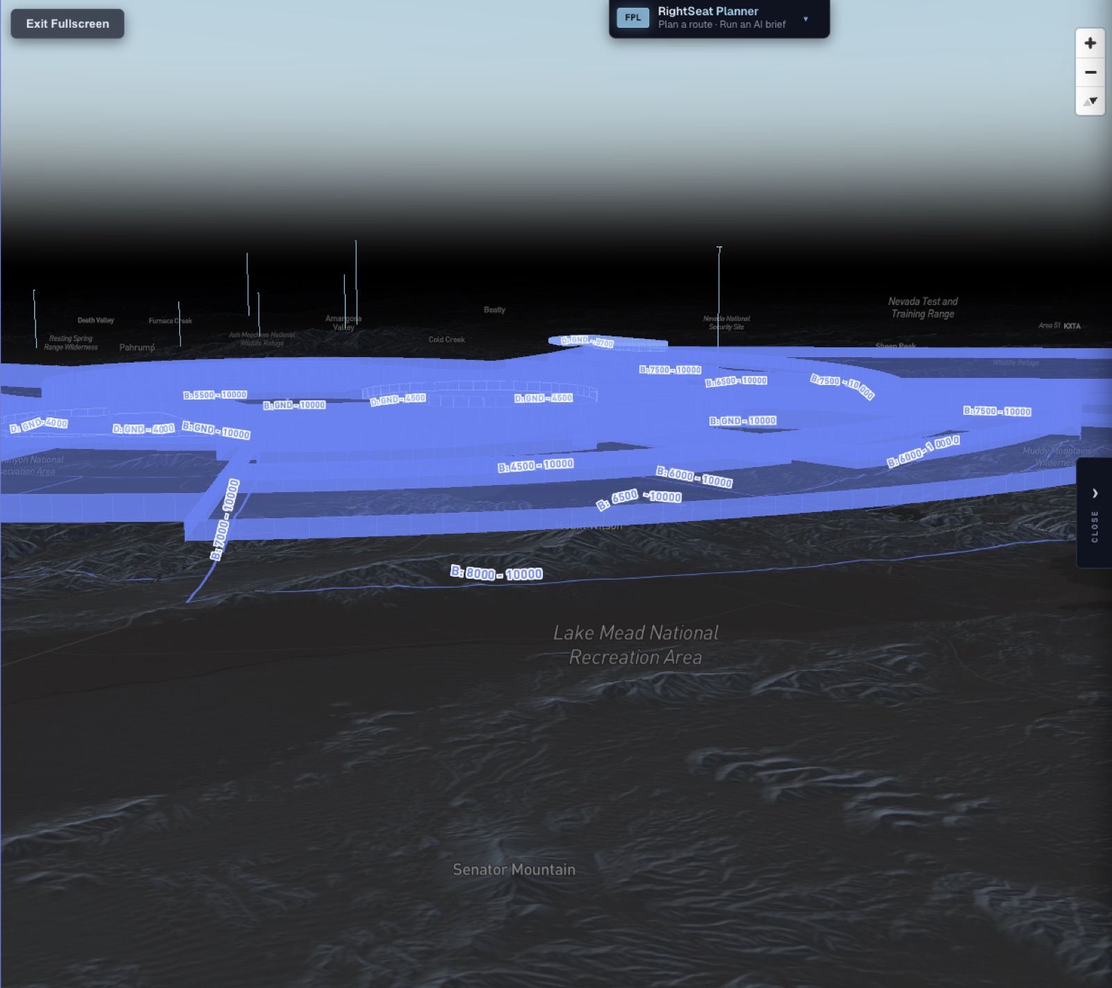
3D terrain elevation mesh beneath airspace floors over the Nevada desert
3D Terrain

Real elevation mesh under your route. See the ridge you’re crossing, not a contour line on paper.

Special-use airspace restricted areas rendered as floor-to-ceiling 3D walls with active status
Special-use airspace

Restricted areas and MOAs as floor-to-ceiling walls, with live active status and the altitude band.

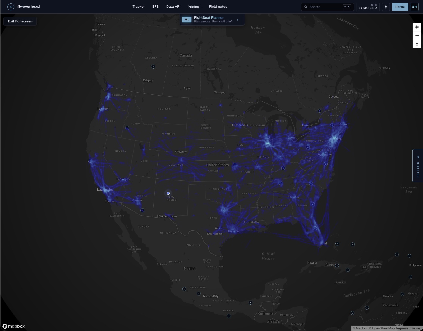
Continental ADS-B traffic density heatmap across the United States
Traffic heatmap

Every ADS-B contact over the last hour as a continental density map - the I-95 corridor, the LA basin, the Atlanta hub, all glowing.

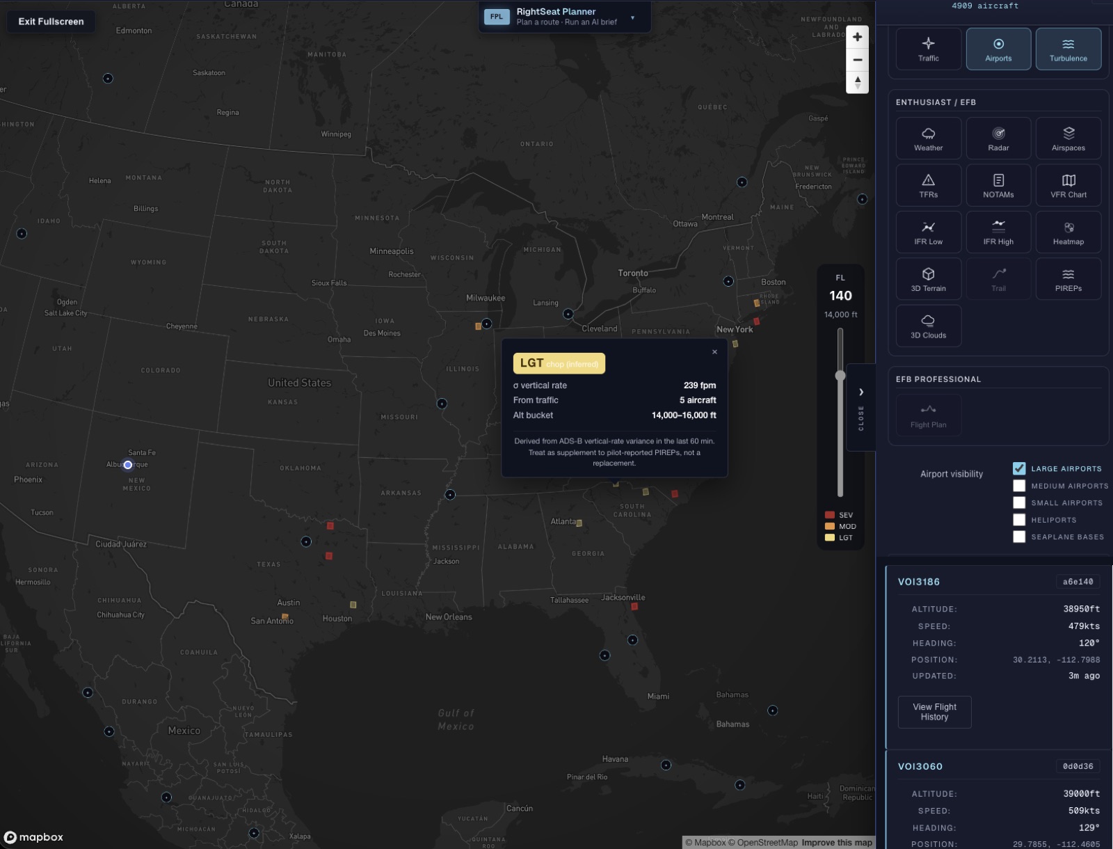
Machine-learning turbulence layer showing inferred light, moderate, and severe chop by altitude band
ML Turbulence

Chop inferred from ADS-B vertical-rate variance across nearby traffic - light / moderate / severe by altitude band, on a flight-level slider. A supplement to PIREPs, not a replacement.

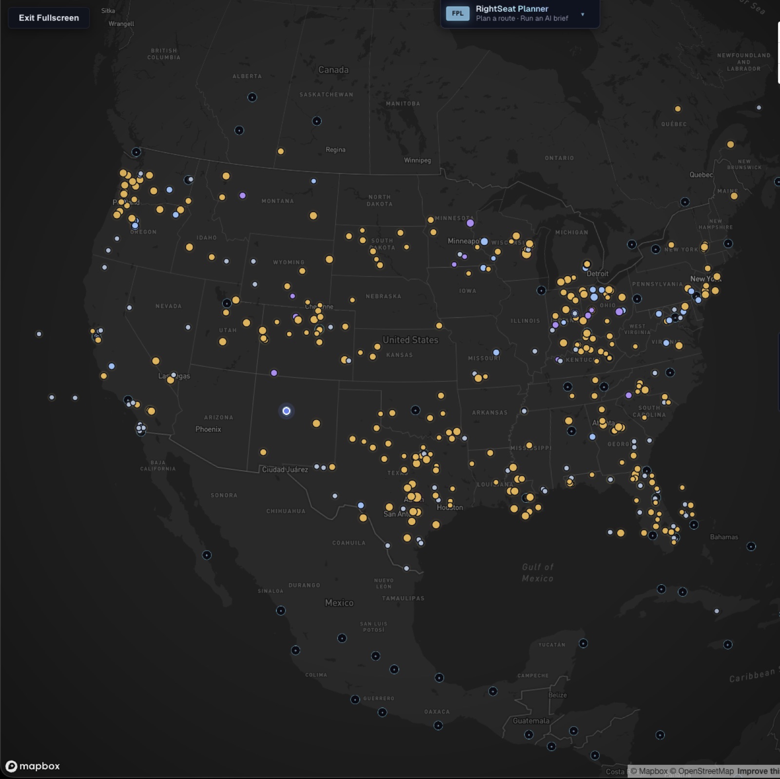
Live pilot reports (PIREPs) plotted across the United States with turbulence and icing heatmaps
PIREPs

Live pilot reports across the country - turbulence and icing, filterable into heatmaps by altitude. The reports that come straight from cockpits.

A route brief that starts with aviation data.

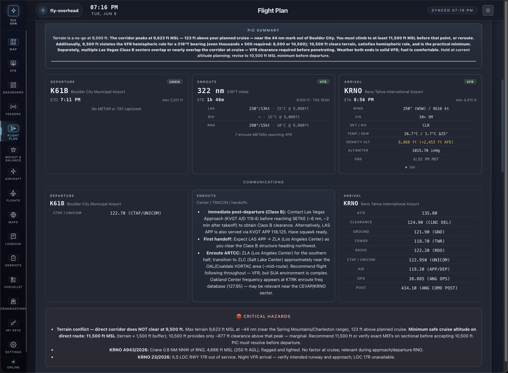
Tell RightSeat where you’re going and it works from the same inputs you already check: FAA terrain, winds aloft, NOTAMs, TFRs, your aircraft profile, and your saved minimums. It drafts the brief so you can verify faster and make the final call.

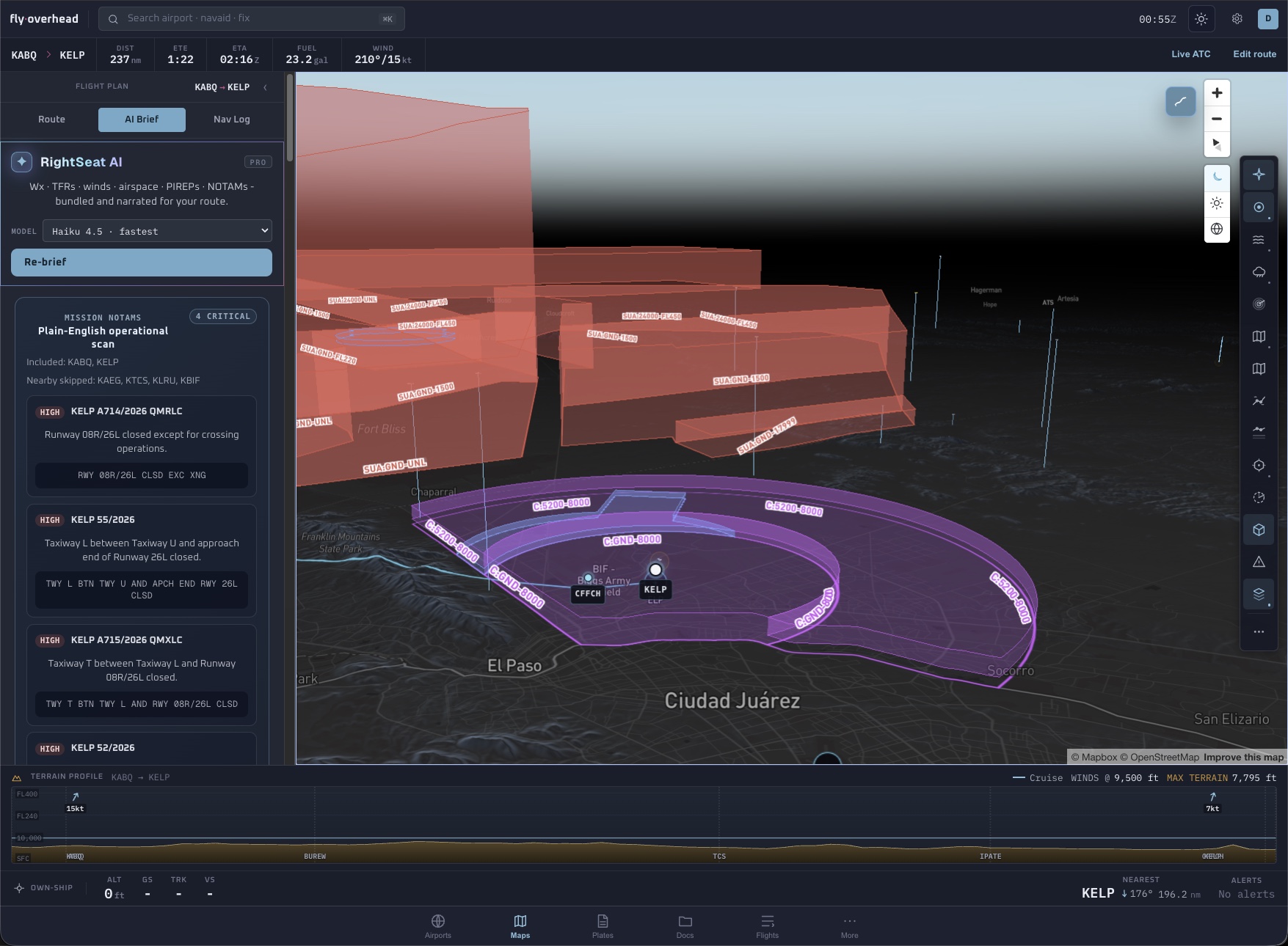
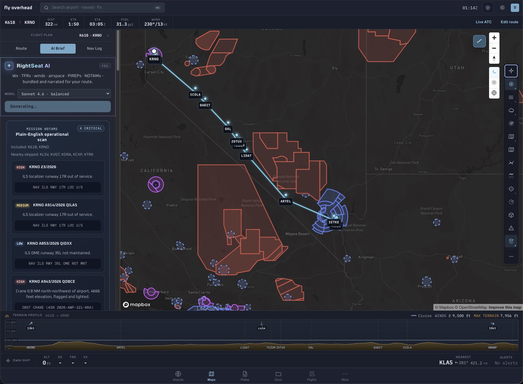
RightSeat AI generated route on the map with terrain profile and special-use airspace avoidanceRightSeat AI flight plan brief with PIC summary, communications, and critical hazards
RightSeat BriefOne request produces the package: route summary, risk notes against your minimums, best-altitude fuel table, auto-reroute around active SUA, enroute weather, and hazard NOTAMs - saveable and cached for the ramp.
  1. 01
    ROUTE BRIEF

    A full PIC brief with POH numbers, departure / enroute / arrival weather, density altitude, hazards, NOTAMs, and a plain-language risk summary against your minimums.

  2. 02
    BEST ALTITUDE

    Runs burn-vs-altitude against vector-averaged winds aloft and picks the cruise that saves the most fuel. KABQ→KLRU: 8,500 ft, 13.6 gal, scored against 10,500 and 12,500.

  3. 03
    AUTO-REROUTE

    Searches around active special-use airspace and terrain - rerouted the KABQ→KLRU corridor around the White Sands R-5107 complex in 692 ms, +17 NM, four waypoints.

  4. 04
    BEST WINDOW

    Compares the next several hours of winds, weather, and inferred turbulence so you can choose a better launch window before you brief.

  5. 05
    VOICE DEBRIEF

    Record a memo at shutdown; it writes the structured logbook entry - crosswind, approach quality, learning notes - ready to import to ForeFlight or MyFlightbook.

  6. 06
    SAVE OFFLINE

    Every brief saves to your plans and caches for offline - pull it up on the ramp with no signal, synced the moment you're back on wifi.

A logbook that fills itself, and a debrief you can fly through.

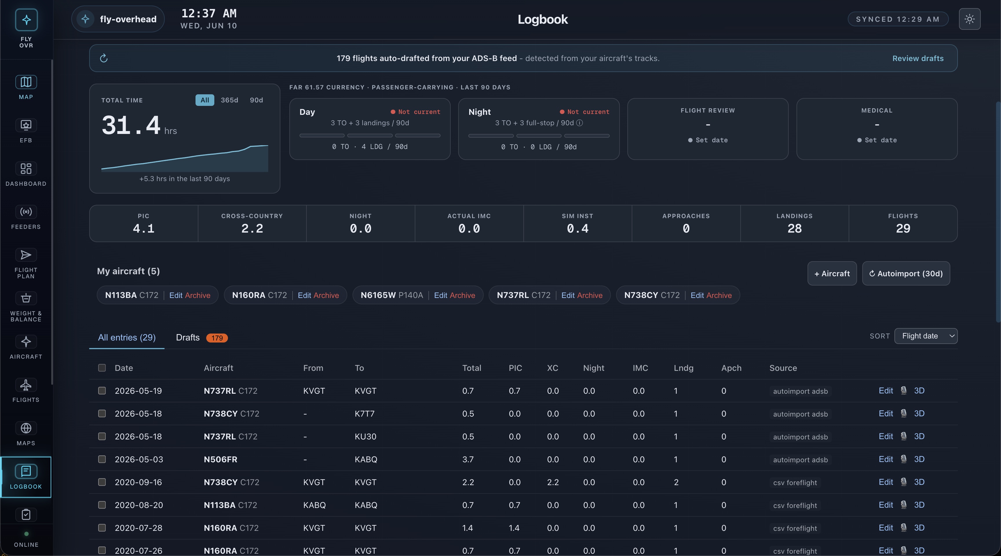
Stop hand-entering Hobbs times. Fly Overhead watches the ADS-B feed for your tail numbers and drafts the logbook entry automatically - then lets you replay the whole flight in 3D, phase by phase.

Smart logbook with ADS-B autoimport, FAR 61.57 currency tracking, and multi-aircraft management
Smart logbook

ADS-B autoimport drafts every flight against your tail numbers. CSV import from ForeFlight & MyFlightbook. FAR 61.51 record-of-record, FAR 61.57 currency tracked automatically across all your aircraft.

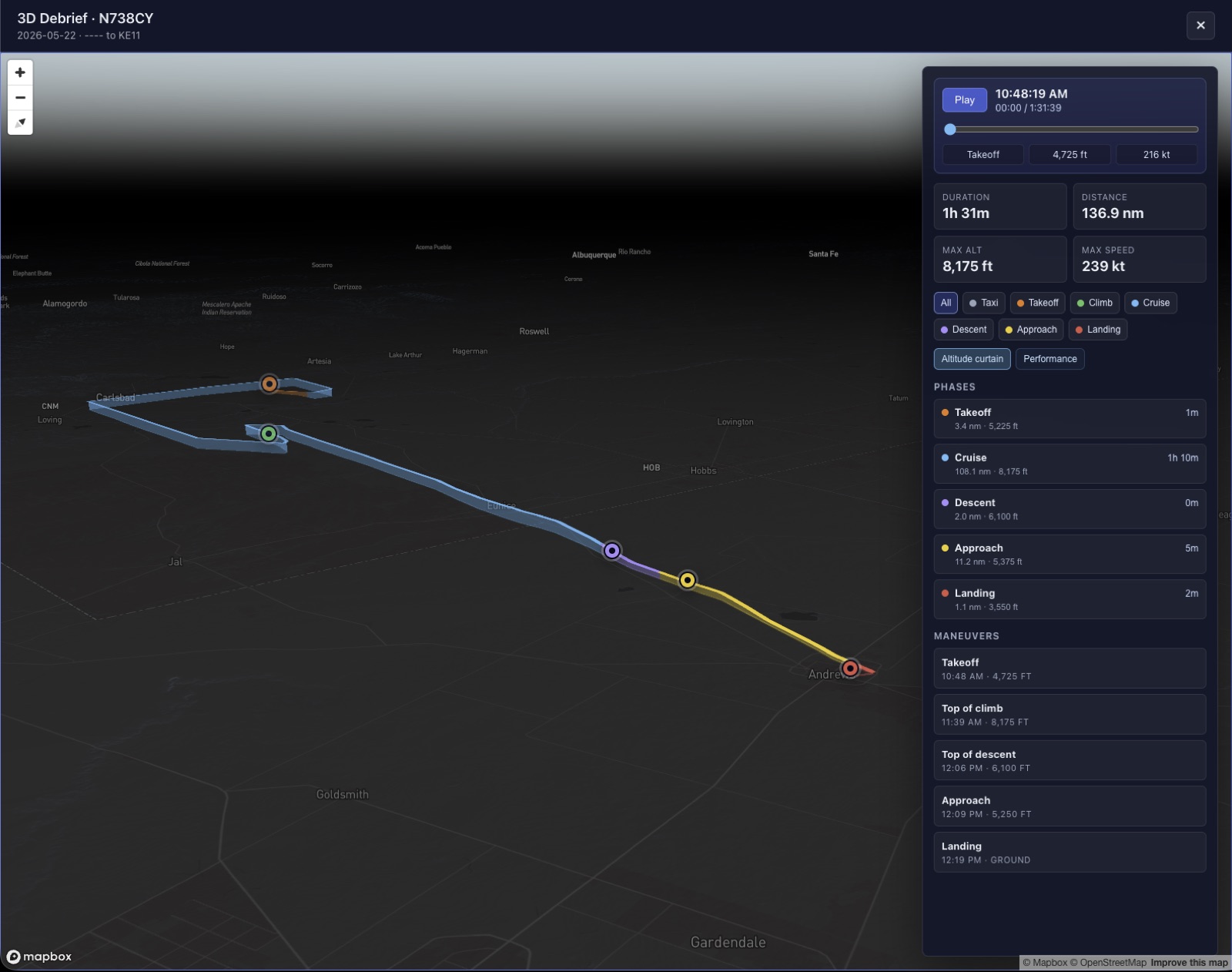
3D flight debrief replay with phase coloring, altitude curtain, and a maneuver timeline
3D Debrief

Replay any flight in 3D - taxi, takeoff, climb, cruise, descent, approach, landing color-coded along the track. Altitude curtain, performance overlay, and a maneuver timeline with the numbers that matter.

Install once. Fly with whatever you brought.

Fly Overhead is a Progressive Web App. The same install runs on iPad, iPhone, Android, and laptop - and caches your charts locally for the last-mile coverage where the cell tower isn’t. No app store gate. No vendor lock. No per-device license.

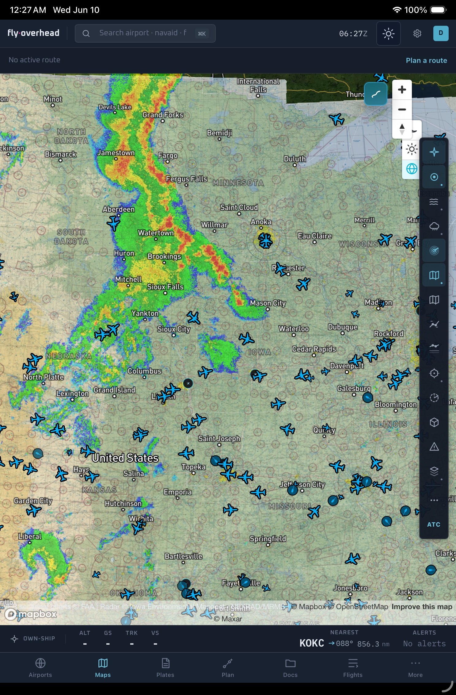
  • Fly Overhead iPad chart and weather view with map overlaysiPadyoke, kneeboard, panel mountPWA installs from any browser
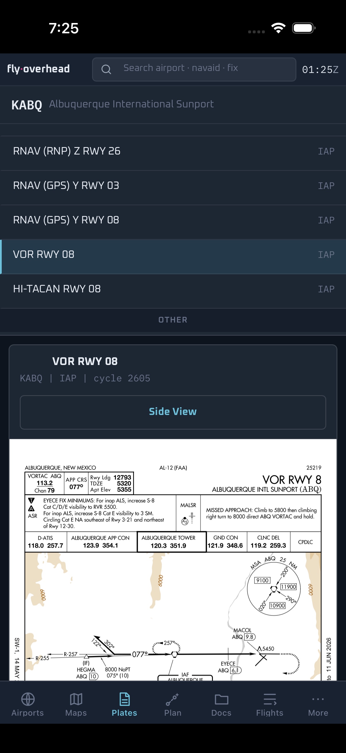
  • Fly Overhead iPhone plate viewer with airport procedure list and chart previewiPhoneright seat, pocket, backupTouch-rendered for kneeboard use
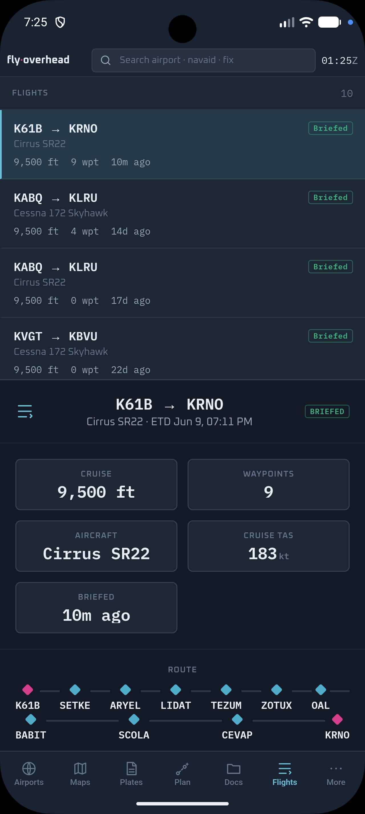
  • Fly Overhead Android flights list with saved AI brief and route summaryAndroidphone or tabletSame install, same charts cache
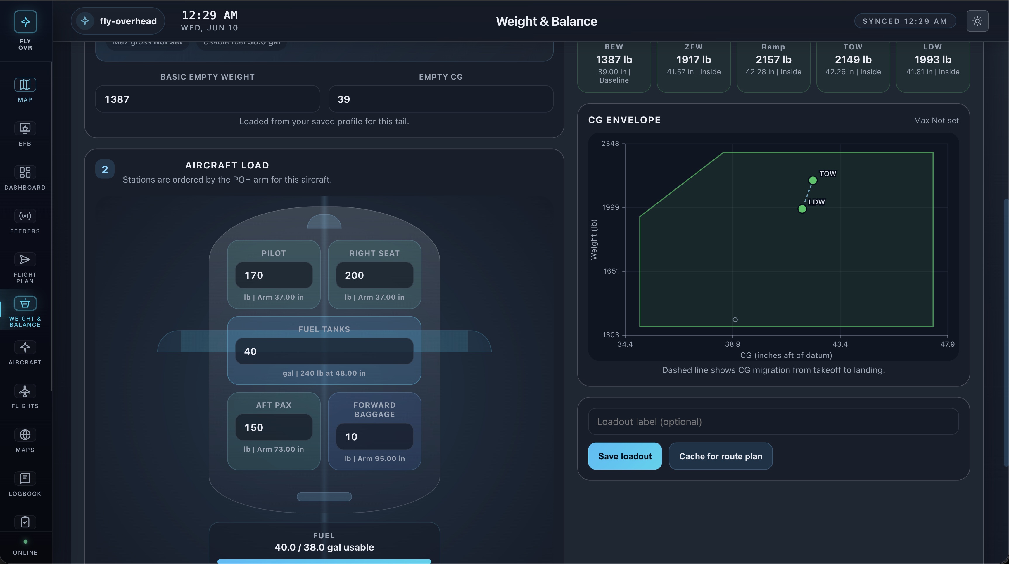
  • Fly Overhead laptop weight and balance planning screenLaptopFBO desk, dispatch room, planningFull-resolution chart layers
PWAAdd to Home Screen on iPad, install from Chrome on Android, drop a shortcut on the macOS dock - same app, same data, same sign-in.
§ 05 / Live ATC

Hear the field. Read it too.

Fly Overhead listens to live ATC and turns it into text in real time, then ties each call to the traffic on your map. The frequency stops being a blur and becomes something you can actually follow.

  • Live transcriptionTower, ground, and approach turned into readable text as the calls happen.
  • Matched to the mapThe callsign on the frequency lines up with the traffic you can already see.
  • Catch what you missedRead back the call you stepped on, on the ramp or in the run-up.
See it in the EFB →

The tracker is free. The EFB is what you sign in to.

The live map stays open to everyone, forever - see overhead traffic without an account. The EFB is the working tool you log in to: charts, planning, RightSeat briefs, the logbook, and the real-time data.

Tracking · Free

Live telemetry

Position, altitude, ground speed, vertical rate, heading, and squawk for every ADS-B-equipped aircraft within view, backed by radar-derived supplemental traffic where ADS-B can’t reach. Built for resilience, so the map keeps moving even when any one source has a bad night.

JBU65BCS3FL340478kt↑0
N172JMC172FL085132kt↑412
N4501CC1523,20094kt↓180
DAL2241B739FL340478kt→0
Overlay · EFB tier

Charts & weather, on the same projection

VFR sectional, IFR low and high, terminal area charts, and approach plates layered on the same map as the live traffic. METAR, TAF, and SIGMET rendered at scale. 28-day FAA cycle, same effective dates as the books in the right seat.

METAR · KABQ · 6 NM SE231453Z 25008KT 10SM FEW090 19/M02 A3001 RMK AO2 SLP170
Lookup · API tier

Aircraft search & flight history

Find any aircraft by ICAO24 hex or callsign - instant recenter with route arrival snap-to. Pull 30 days of history by tail, replay any flight, or hand the same normalized feed into your own dispatch tool over WebSocket or REST. All the information from the FAA at your fingertips.

GET/v1/aircraft/a35949
GET/v1/aircraft/JBU65/track?since=24h
WS/v1/stream?bbox=-110,33,-105,38
Runway approach lights at dusk

“I open three tabs every morning: my POH, usairnet, and Fly Overhead. The third one is the only one I haven’t tried to replace.”

A. EwertPPL · KAEG → KFHR · Cessna 172

Writing on aviation, ADS-B, and how the product gets built.

All field notes
Aircraft wing over scattered cloud
Begin

Take it up for a circuit.

The live map is free, forever. The EFB starts at $7.99 / month. The data API is usage-based or month-to-month. No vendor lock, no data-export tax.