Before pilots had moving maps, GPS position, ADS-B traffic, radar weather, and terrain overlays, air navigation could be startlingly literal. In parts of the United States, a pilot looked out the window and followed a giant concrete arrow on the ground to the next beacon. At Fly Overhead, our ambition is to become a modern version of that trusted reference: the aviation app pilots look to when they need the sky to make sense.
Then: concrete arrows made air navigation visible
Early airmail pilots were not flying behind today's wall of avionics. They had compasses, clocks, charts, rivers, railroad tracks, towns, weather judgment, and their own eyes. That worked well enough in daylight and good visibility. It worked much less well at night, over unfamiliar terrain, or when weather erased the usual landmarks.
The federal answer was the lighted airway. Along the Transcontinental Air Mail Route, the government built a chain of beacon stations with bright rotating lights and large concrete arrows that pointed toward the next station. The National Postal Museum describes beacons erected roughly 10 miles apart, with rotating lights visible to pilots many miles away. The concrete arrow was the daytime readout. The beacon was the night readout. Together, they turned a route into something a pilot could follow with confidence.
It is easy to smile at the simplicity of the system. Still, there is a beautiful engineering honesty in it. The pilot needed direction, so the country put direction on the ground. The pilot needed continuity, so the country repeated that direction every few miles. Pilots looked to those concrete airway markers because the markers compressed uncertainty into a simple, readable cue. The interface was not a screen. It was a landscape.
Now: the modern EFB map moves with you
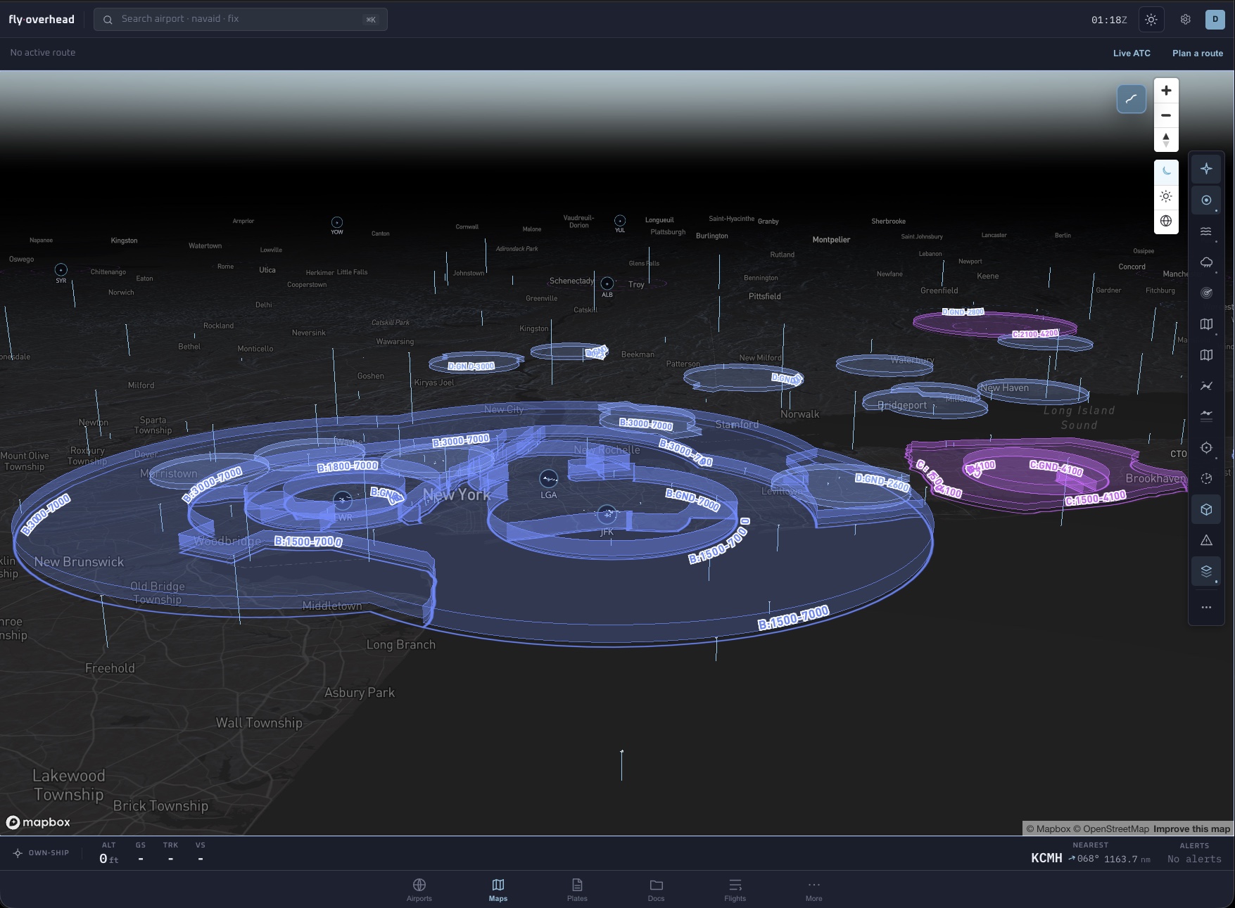
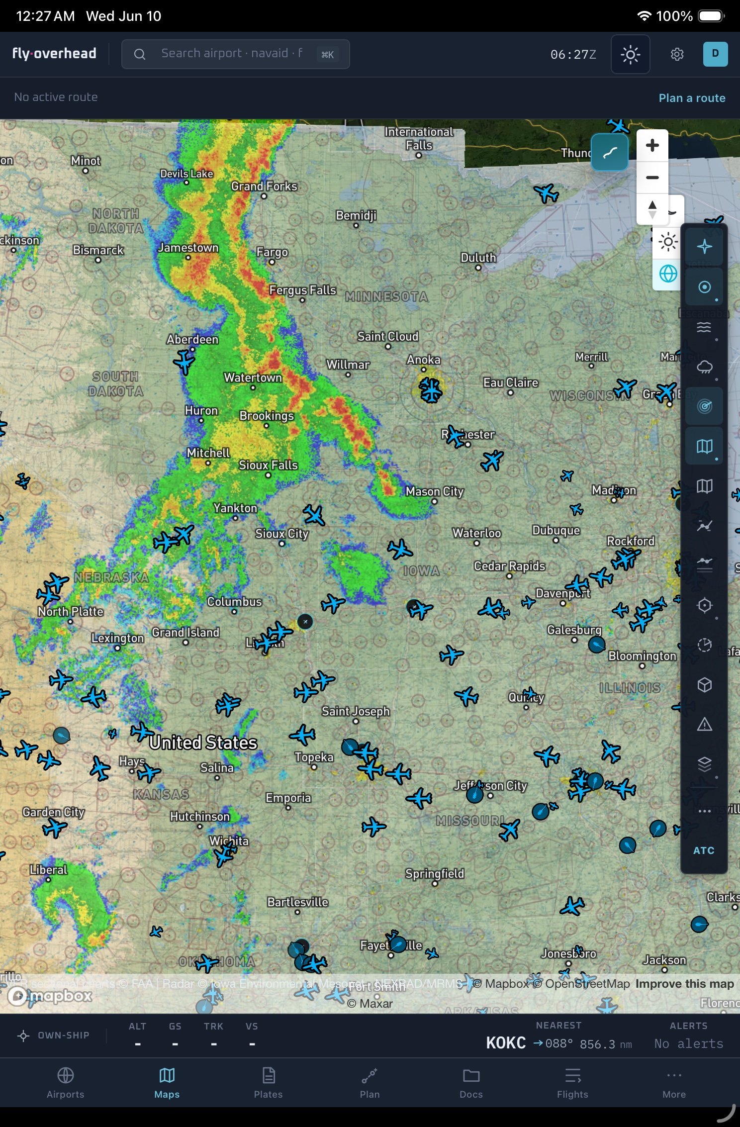
Modern air navigation has flipped the relationship between pilot and route. The old system asked the pilot to find the next fixed object in the world. A modern Electronic Flight Bag starts by knowing where the aircraft is, then draws the world around that position. Your chart, traffic, airspace, weather, terrain, airport data, and route are no longer separate mental piles. They can live in the same moving picture.
That is a profound change. A concrete arrow gave one kind of answer: continue this way. A modern aviation map can answer a stack of related questions at once. What airspace am I about to enter? What terrain rises along the route? Where is nearby traffic? How old is this weather picture? What runway and procedure matter at the destination? The pilot still has to think, verify, and decide, but the raw search burden is much lower.
A trusted pilot reference, not primary navigation
The tools changed almost beyond recognition. The responsibility did not. The old airway beacon was a navigation aid, not a guarantee. A pilot still had to account for wind, weather, fuel, mechanical condition, and judgment. Modern EFBs are the same kind of creature, even when they look far more sophisticated. They make information easier to gather and compare. They do not make the flight for you.
That is why Fly Overhead is careful about the word advisory. Live traffic, route briefings, PIREPs, airspace visualization, terrain views, and AI-assisted summaries are there to help a pilot form a better picture. They are not a substitute for certified navigation equipment, current FAA charts, ATC clearances, required instruments, or pilot training.
The common thread is trust
The concrete-arrow era and the moving-map era share a deeper design question: what does a pilot need to trust in order to keep moving safely? In the 1920s, trust meant spotting the next beacon and knowing it belonged to a route maintained for air mail. Today, trust means knowing where data comes from, how fresh it is, what it can show, and what it cannot show.
A good aviation app should respect that. It should make uncertainty visible. It should avoid pretending that a polished interface is the same as authority. It should help the pilot compare sources quickly, then get back to flying the aircraft.
What we want Fly Overhead to become
We want Fly Overhead to earn the same kind of instinctive place in a pilot's workflow that concrete arrows once held in the landscape. Not because a phone or tablet replaces a certified panel. It does not. We mean something more practical and more durable: when a pilot needs to understand what is around them, what is changing, and what deserves attention next, Fly Overhead should be one of the first places they look.
That means building an air navigation app around trust instead of noise. Live ADS-B traffic should be easy to scan. Airspace should be readable without forcing the pilot to mentally unfold every shelf. Weather, PIREPs, charts, airport data, route briefings, and terrain should fit together naturally. The app should answer the orientation question first: where am I, what is around me, and what is likely to matter?
From concrete arrows to aviation layers
The old concrete arrows are charming because they are so direct. They point. That is all. Their survival in deserts, hillsides, and city parks is a reminder that air navigation has always been a conversation between the pilot and the world below.
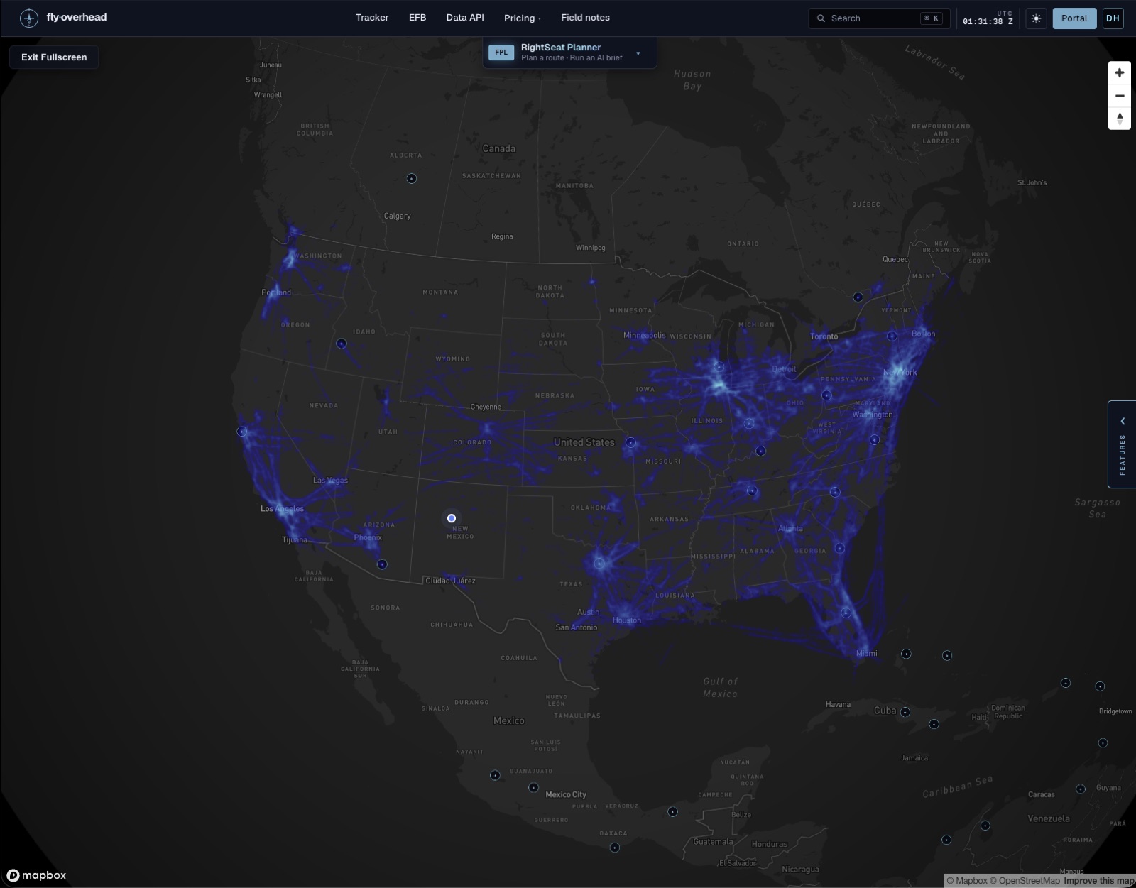
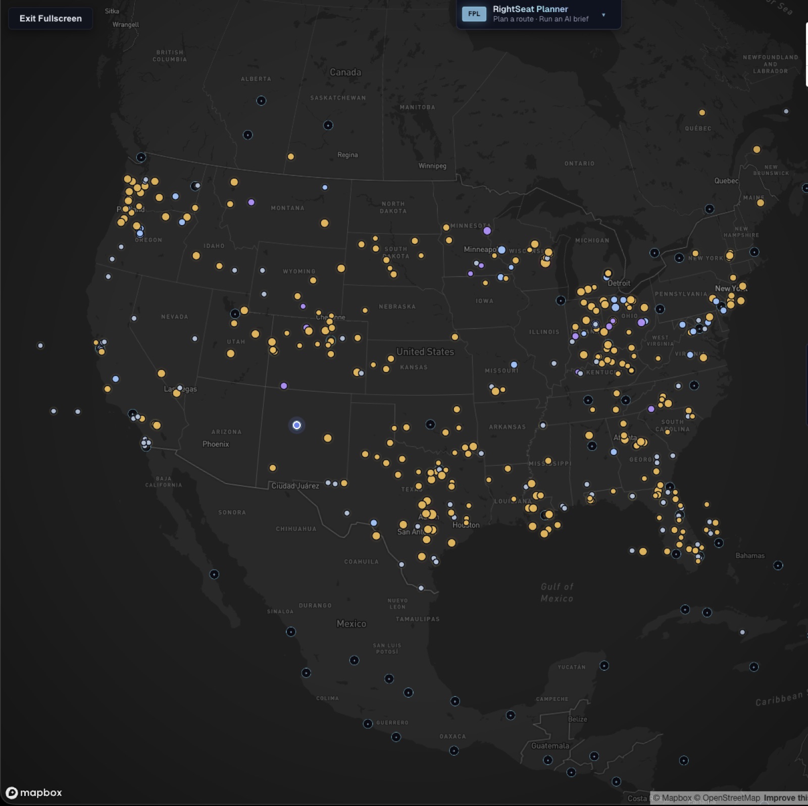
Fly Overhead exists in the same lineage, even though the medium has changed. Instead of a single arrow pointing toward the next beacon, the app gives pilots and aviation-curious people a layered view of the sky: traffic moving in real time, airspace drawn in context, charts and weather on the same surface, and route intelligence that can be reviewed before and after the flight.
Navigation has gone from concrete to computation, but the goal is familiar: make the invisible route easier to see.
Air navigation FAQ
What were concrete arrows used for in air navigation?
Concrete arrows were part of the early US lighted airway system. They pointed pilots along airmail routes toward the next beacon station, helping make long-distance air navigation easier before GPS and modern moving maps.
What is a modern EFB?
An Electronic Flight Bag, or EFB, is a digital aviation tool that can bring charts, weather, airport information, route planning, documents, and other flight context onto a tablet, phone, or web app.
Can Fly Overhead replace certified navigation?
No. Fly Overhead is advisory only. It is designed to help pilots build situational awareness, review live aviation context, and prepare more thoughtfully, but pilots must rely on certified equipment, current official charts, ATC clearances, and required training for primary navigation.